Beyond Borders: Rethinking Historical Maps
Historians have long relied on maps to understand the past. They reveal how civilizations were connected, expanded, and changed over time, helping to make complex historical events across vast distances and centuries easier to grasp.
Yet maps can be misleading. The problem is not one of accuracy; rather, maps often simplify realities that were far more complex and uncertain than static images can convey.
To understand why, we must first recognise that maps are not neutral representations of the past, but interpretative sources shaped by the decisions, priorities, and perspectives of their creators.
Maps are Interpretative Sources
Despite appearing scientific and authoritative every map reflects the choices of the maker, shaping how viewers interpret the past. Static historical maps are not wrong but treating them as subjective texts enables researchers to explore the richer realities they represent. By doing so, we gain a deeper understanding of both maps as a form and history itself.
Beginning in the late twentieth century, scholars in the field of critical cartography argued that maps should not be treated as neutral sources. J. B. Harley’s seminal text Deconstructing the Map encouraged historians to look beyond the apparent objectivity of maps and examine the social and political context in which they were created. This is particularly important when examining historical maps.
Harley finds maps to be a form of ‘power-knowledge’, helping to reinforce legal claims, territorial ambitions, and existing hierarchies. One of the clearest examples of this can be seen in the way historical maps represent political boundaries.
A map commissioned by a monarch or government will exhibit their political agendas as much as the geographic realities.
The Illusion Created by Static Mapping
Static historical mapping often falsely depicts political borders as clear and well-defined. For modern readers, national boundaries are represented as precise, with countries appearing as distinct entities. However, historical states did not function in the same way, and many borders were far less certain.
Historical geographers have long noted that political authority faded gradually rather than abruptly ending at a boundary (Gregory and Ell, 2007)., could be contested, sparsely governed, or shared between multiple powers.
In many cases people living near a border would not have had precise knowledge as to where one realm ended and another began. Therefore, when historical maps draw sharp lines around territories, they can create a false impression of certainty.
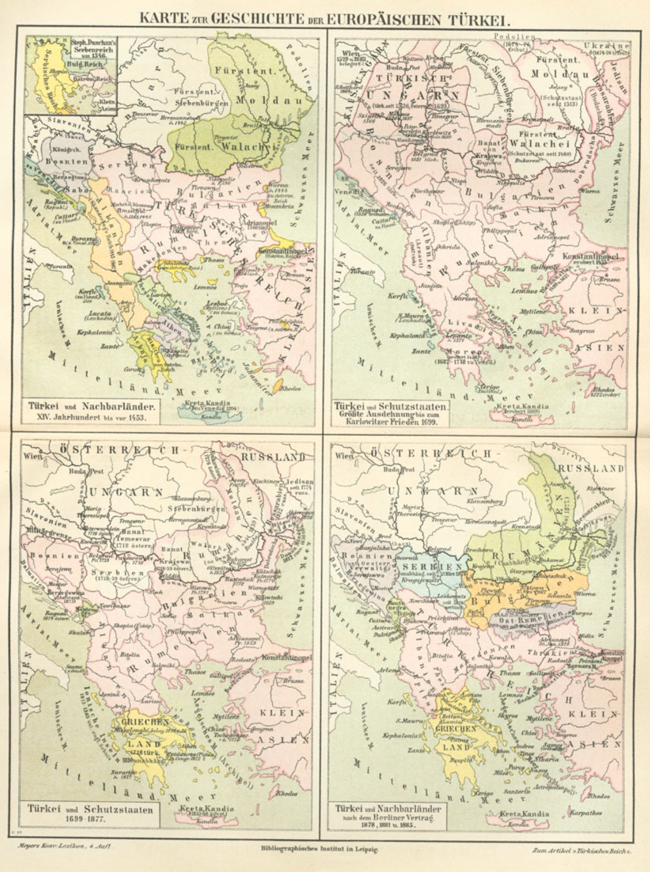
Historical empires and their political, cultural, and economic influences are fundamentally dynamic. For example, the Ottoman Empire reached its greatest territorial extent in the late seventeenth century. Stretching across Southeast Europe, North Africa, the Middle East, and parts of the Caucasus, the empire appeared as a vast and unified political entity. By comparing static maps, the evolution of the empire can be seen, but only as a series of snapshots.
They do not easily provide a visualization of the gradual expansion from a small Anatolian principality into a major imperial power, nor do they show the shifting balance of authority within the empire itself. Some regions were governed directly from Constantinople, while others garnered significant autonomy under local rulers or provincial governors (Faroqhi, 2008).
Figure 1. Sequence of maps depicting the territorial development of the Ottoman Empire, from Meyers Konversations-Lexikon (4th ed., c. 1895). Although the series illustrates territorial change over time, it still presents history as a succession of static moments rather than a continuous process of political transformation.
Static mapping often obscures gradual change. Territories were gained and lost through wars, treaties, revolts, and administrative reform. Comparing maps a few decades apart in origin can expose the results of these boundary changes but cannot dynamically show the slower movement of governance. Historical maps therefore freeze political change into single images, making complex historical processes appear as fixed and inevitable.
Towards More Dynamic Historical Mapping
Historical maps often place states and territorial boundaries at the center of the story. Yet many of the most significant developments in world history did not follow political borders. Trade routes spread ideas far beyond the states in which they originated through a network of merchants, scholars, and travelers.
A map showing territorial control may uncover governing powers but tells us little about the movement of people, goods, and knowledge. By prioritizing political geography, traditional maps can unintentionally obscure the wider cultural and economic connections that shaped historical change.
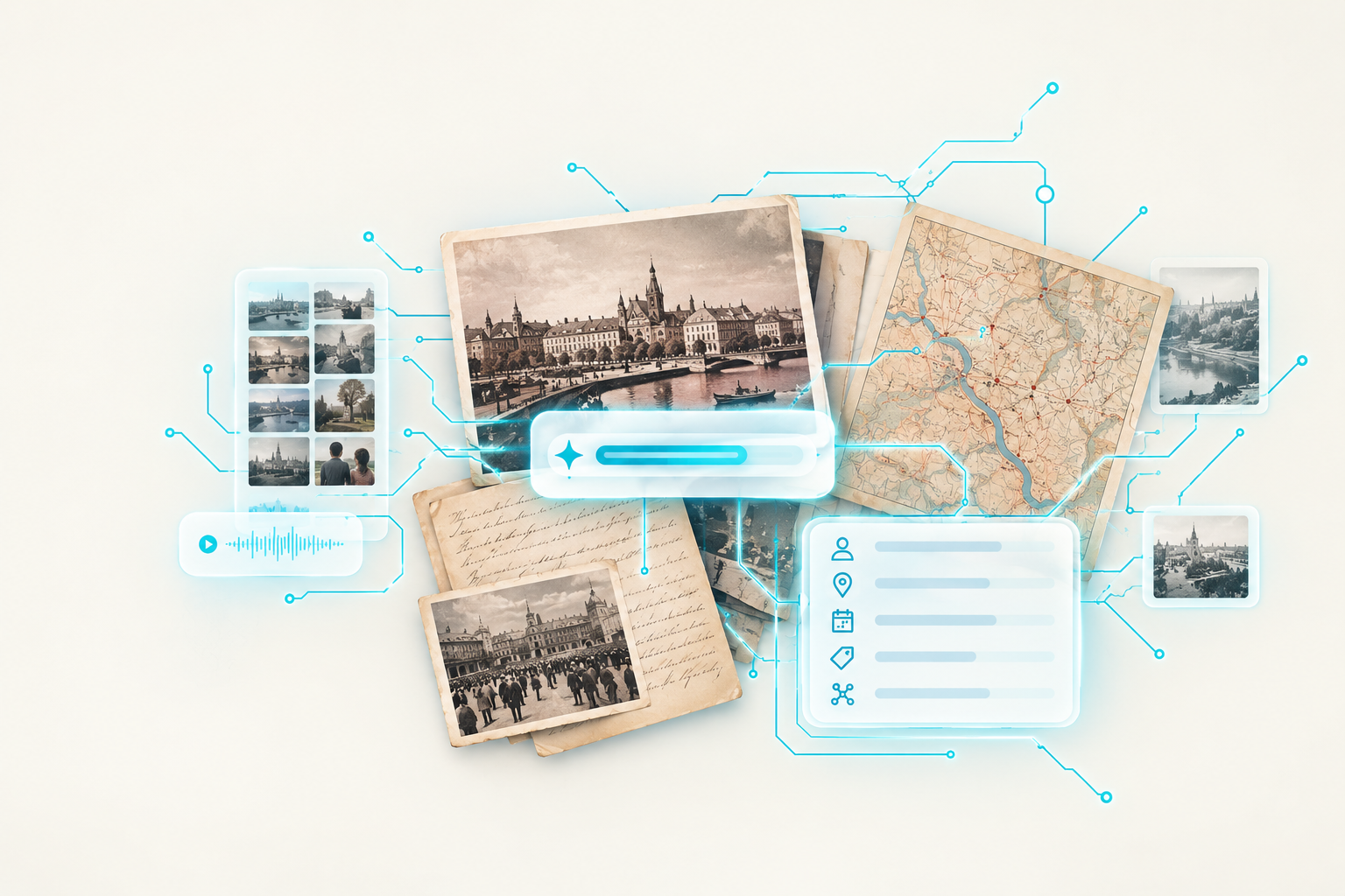
Many of the limitations surrounding traditional mapping are being addressed by advances in digital technology. Digital humanities scholar Eero Hyönen argues that the field is increasingly moving from digital data publishing to data analysis and serendipitous knowledge discovery.
Rather than simply displaying historical information, digital tools now allow researchers to uncover hidden relationships between people, places, and events.
Interactive maps can reveal gradual change rather than isolated snapshots. Historical datasets can represent uncertainty, overlapping spheres of influence, and connections across political, economic, cultural, and environmental history.
Instead of asking what the world looked like in a particular year, historians can explore how places evolved over time. However, dynamic mapping does not replace traditional cartography but builds upon it.
By visualising uncertainty, movement, and interconnectedness, it offers a richer representation of the past and encourages us to see history as a process rather than as a series of fixed moments.